Summer and running. Probably the last two things that come to mind when someone says Niseko. But if you speak to local trail runner and entrepreneur Chris Pickering, and you’ll be lacing up and heading for the hills — literally.
A long-time Japan resident, Chris has completed ten marathons, tackled multiple ultramarathons, and flirted with the 100-mile mark more than once. So when he says Niseko is just as epic in trail shoes as it is on skis, we take notice.
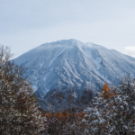
“Once the snow melts, Niseko’s running world really comes alive,” he says. “There are great trails to explore, and the views are just unreal sometimes. You can see Mount Yotei from almost anywhere.”

When he’s not clocking kilometres through forests and farmland, Chris runs UCHI, a digital platform connecting global investors with property opportunities across Japan. Out on the trail, however, it’s all about silence, fresh air, and that rare joy of being completely, blissfully, off the grid.
From a riverside loop to a full circumnavigation of Mount Yotei, Chris shares three of his favourite routes that prove Niseko’s green season deserves your sweat.

Read next: Niseko Summer Travel Guide: Private Onsen, Golf Courses & Matsuri
Route 1: The Riverside Loop
Distance: 12km
Vertical gain: ~200m
Start/End: Hirafu Intersection
Terrain: Trail and road mix
Gear: Off-road running shoes recommended
Good to know: Suitable for casual runners or those training around 10km. Best in dry weather.

This is Chris’s go-to when time is short but the legs are ready. Starting from Hirafu, the route opens with a relaxed downhill stretch along the pavement past Izumikyo, easing you into the run. First stop: the St Moritz Bridge. On the right morning, Mount Yotei hangs perfectly over the Shiribetsu River — a picture worth pausing for.
From there, the road slips away as you turn left and drop onto a riverside path that winds quietly toward Kutchan. Expect some mud, the occasional downed branch, and near-total calm. For a few kilometres, it’s just you, the trees, and Yotei-san glowing across the farm fields.
Read next: 6 Top Mount Yotei Photo Spots in Niseko That Are Not From The Slopes

At the bridge into town, you have options: retrace your steps for a soft trail return, or turn right for a slow-burning hill climb that brings you back via the main road. Just before you ascend, take a second photo — this time looking back at Hirafu, with Mount Annupuri rising behind it.
Still have some gas in the tank? Add on a detour to Lake Hangetsu. Follow Route 5, turn left, and loop the volcanic crater lake — 2km of singletrack through pine forest. It’s an easy extra to tack on, but the atmosphere is a world away.
Route 2: The Yotei Loop
Distance: 48km
Vertical gain: ~700m
Start/End: Hirafu Intersection
Terrain: All road or pavement
Gear: Marathon road shoes, water, fuel, sun protection
Good to know: A big day out! Bring water, fuel, sun protection, and plan for a few hours on your feet.

Circling an entire volcano might sound extreme, but this loop is surprisingly runnable — paved nearly end to end, with quiet roads, rolling hills, and a backdrop that shifts with every kilometre. Just make sure you’re prepared. There are natural springs to refill bottles, and a convenience store around halfway, but most of the route is remote so it’s best to start early, especially in summer.
From Hirafu, head down Route 5 and turn left toward Kutchan. Just after Homac, cut right and settle into a long stretch toward Kyogoku — expect a few punchy hills and brief sections without pavement. Traffic is light and locals are used to runners, cyclists, and the occasional hiker on the shoulder.
At 17km, you’ll reach Fukidashi Park, which is your first real break. The spring water here comes straight from Mount Yotei and tastes like a reward. There’s a Lawson just up the road if you need to refuel. From there, turn right and make your way toward Makkari. This section is open, quiet, and ideal for headphones — just keep glancing right. Yotei-san’s profile changes with every clearing, offering up some of the loop’s best views.
Another natural spring appears around the 33km mark, which is your final chance to top up. A few kilometres later, you’ll shortcut back to Route 5 for a straight stretch with wide road shoulders. The finish takes you past Hirafu Station and up through Kabayama — the final climb to cap off the day.
It’s long, yes. But if you’re after that meditative rhythm only big runs deliver — and a chance to see all sides of Niseko’s iconic peak — this one earns its place on the list.

Route 3: Niseko Trail Loop
Distance: 27km
Vertical gain: ~2,100m
Start/End: Goshiki Onsen
Terrain: 95% trail
Gear: Trail shoes, waterproof jacket, fuel, layers
Good to know: A high-alpine route with changing weather. Bring layers, fuel, and friends!

This is the big one. An all-day mountain loop that threads through peaks, lakes, marshlands, and forests — and serves up some of the most dramatic trail running in Hokkaido. Expect to be out for at least 5–6 hours, and pack like it. The weather can shift quickly up top, and the elevation gain is real.
The route was dreamt up by Yoshitaka Toge, owner of Sprout Coffee and something of a legend in the local trail running scene. Best tackled with company, this route includes some technical climbs, fast descents, and moments where you’ll be grateful you brought backup.
Start at the car park just past Goshiki Onsen. You’ll pass the lake at Iwaonupuri, then head into the marshlands of Shinsennuma with cinematic views of Mt Yotei rising beyond. From there, the trail loops around Naganuma (“long lake”) before climbing Mt Chisenupuri — your first real summit. On clear days, the view stretches to the Sea of Japan and across the full Annupuri range.
The descent from Chisenupuri brings you back toward the trailhead, where you’ll want to refuel, because next up is Mount Annupuri. There’s a climbers’ logbook at the trailhead (worth signing), and while the 2km climb is steep, it’s runnable. The ridgeline views are stunning, and at the summit you’ll spot the hut that marks the start of so many winter powder missions. In summer, the view is all Ezo-Fuji: Mount Yotei in full, commanding symmetry.
From there, it’s a fast descent toward the Annupuri ski resort. But before you get too comfortable, the route throws in one last uphill kicker — back toward Goshiki, and your finish line.
It’s type-2 fun, as the runners say. It’s demanding, remote, and not for beginners — but as Chris says, it’s a day you won’t forget.
The Finish Line
“Just enjoy the views. Whether you’re on the road or a trail somewhere, you are always one corner away from an incredible viewpoint,” says Chris. “You don’t need to worry about time. Take some water and a smartphone and you’ll then be able to find your way home if you get lost as well as take some great snaps for the memories!”
Whether you’re here to train, explore, or simply move, these routes prove there’s more to Niseko than snowfall and après-ski.In summer, the trails come alive — and you might just find a new favourite season.
Read next: Golf in Hokkaido: Where To Tee Off In Niseko, Rusutsu and Furano
Looking to reconnect with Nature? Read these next:
Summer In Japan: Why You Need A Coolcation In Hokkaido
72 Hours in Furano: Summer Edition
Hiking in Phuket: Samet Nangshe Viewpoint & Waterfall Trails


